
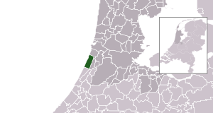
Fiùra:Map - NL - Municipality code 0473 (2009).svg

Grannezza 'e sta PNG mostra 'e stu SVG file: 300 × 160 pixel. Ati resoluziune: 320 × 171 pixel | 640 × 341 pixel | 1 024 × 546 pixel | 1 280 × 683 pixel | 2 560 × 1 365 pixel.
File 'e origgine (File SVG, dimenziune nommenale 300 × 160 pixel, dimenzione d' 'o file: 530 KB)
| Descrizzione |
|
|||
| Data | ||||
| Funte | own work , using CBS data | |||
| Autore | Michiel1972 (talk) 22:45, 24 January 2009 (UTC) | |||
| Premmesse (Riausanno stu file) |
Attribution ShareAlike 3.0 |

.svg)
Stu file è licenziato sott'a na licienza Creative Commons Attribution-Share Alike 3.0 Unported
- Vuje site libbero:
- pe spartere – pe' cupià, distribbuì e trasmettere 'a fatica
- p'ammescà – pe' putè adatta 'a fatica
- Sott' 'e cundiziune ccà abbascio:
- attribbuzione – Avite a dà criéreto, nu cullegamiento â licienza, e avite a dicere si nce avite cagnato quacche cosa. 'O pputite fà comme vulite, ma nun putite fà ntènnere ca chi tène 'a licienza ve sustene a vuje o â fatica vosta.
- sparte eguale – Si vuje cagnate, trasformate o fravecate coccosa ncopp'a sta fatica, allora avíte a distribbuì 'a fatica fatta cu 'a stessa licienza o na licienza cumpatibbele a chella origgenale.
Cronologgia d’’o file
Fa’ clic ncoppa a na data/ora pe vedé comme s'appresentava 'o file a chillo mumento.
| Data/Ora | Miniatura | Dimenzione | Utente | Commento | |
|---|---|---|---|---|---|
| attuale | 00:45, 25 Jen 2009 | | 300 × 160 (530 KB) | Michiel1972 | {{Information |Description=*Location maps for the 441 municipalities in the Netherlands. Boundaries 1/1/2009 *Automatically generated with script *File name contains "Municipality code" (CBS-code) as specified in: [http://www.cbs.nl/nl-NL/menu/methoden/c |
Jonte ê ffiure
Pe' nisciuna paggena ce buò stu file.
Auso globbale d’’o file
'E wiki ccà abbascio aúsano stu file:
- Uso ncopp'a ar.wikipedia.org
- Uso ncopp'a ca.wikipedia.org
- Uso ncopp'a el.wikipedia.org
- Uso ncopp'a en.wikipedia.org
- Uso ncopp'a es.wikipedia.org
- Uso ncopp'a eu.wikipedia.org
- Uso ncopp'a fa.wikipedia.org
- Uso ncopp'a fr.wikipedia.org
- Uso ncopp'a ga.wikipedia.org
- Uso ncopp'a gl.wikipedia.org
- Uso ncopp'a hu.wikipedia.org
- Uso ncopp'a hy.wikipedia.org
- Uso ncopp'a it.wikipedia.org
- Uso ncopp'a la.wikipedia.org
- Uso ncopp'a lb.wikipedia.org
- Uso ncopp'a mk.wikipedia.org
- Uso ncopp'a nl.wikipedia.org
- Uso ncopp'a ru.wikipedia.org
- Uso ncopp'a stq.wikipedia.org
- Uso ncopp'a th.wikipedia.org
- Uso ncopp'a tr.wikipedia.org
- Uso ncopp'a uk.wikipedia.org
- Uso ncopp'a www.wikidata.org
- Uso ncopp'a zh-min-nan.wikipedia.org
- Uso ncopp'a zh.wikipedia.org
.svg)