
Fiùra:Black Sea location map.svg

Grannezza 'e sta PNG mostra 'e stu SVG file: 532 × 330 pixel. Ati resoluziune: 320 × 198 pixel | 640 × 397 pixel | 1 024 × 635 pixel | 1 280 × 794 pixel | 2 560 × 1 588 pixel.
File 'e origgine (File SVG, dimenziune nommenale 532 × 330 pixel, dimenzione d' 'o file: 86 KB)
Riepilego
| Descrizzione |
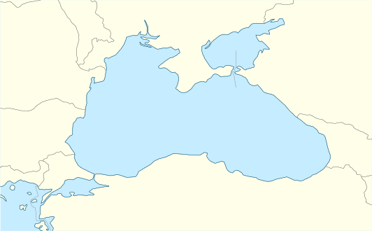
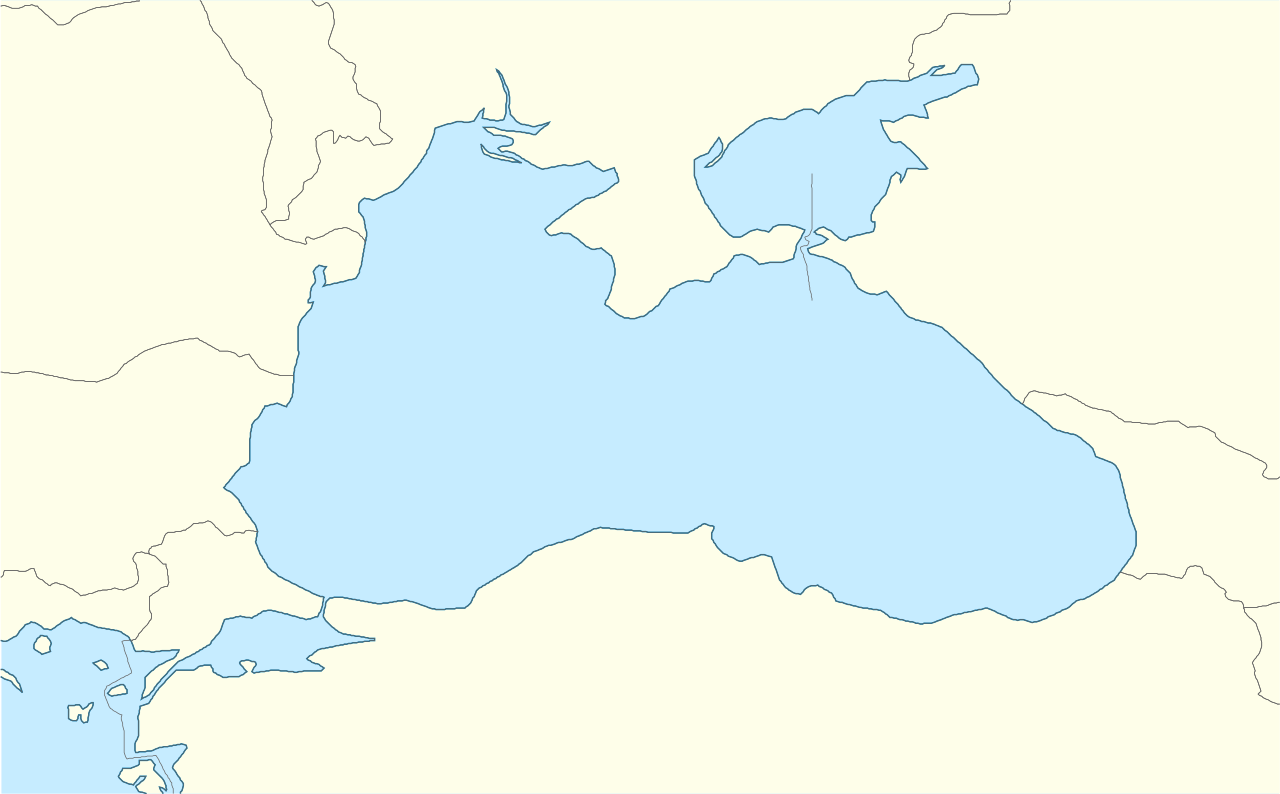
English: Location map of the Black Sea.
|
| Data | |
| Funte | Fatica propria |
| Autore | Tentotwo |
Shell script for generating the map using GMT
#!/bin/sh

# Set common options
PROJECTION=Q34/43.5/15c
REGION=24/44/39/48
FILENAME=Black_Sea_location_map.ps

# Get Natural Earth datafiles
echo "Downloading datafiles from naturalearthdata.com"
wget -nv -nc \
 http://www.naturalearthdata.com/http//www.naturalearthdata.com/download/50m/physical/50m-coastline.zip\
 http://www.naturalearthdata.com/http//www.naturalearthdata.com/download/50m/physical/50m-land.zip\
 http://www.naturalearthdata.com/http//www.naturalearthdata.com/download/50m/cultural/50m-admin-0-countries.zip
echo "...done\n"

echo "Inflating archives"
unzip 50m\*.zip
unzip 110m\*.zip
echo "...done\n"

echo "Converting shapefiles to GMT"
ogr2ogr -F GMT 50m_land.gmt 50m_land.shp
ogr2ogr -F GMT 50m_coastline.gmt 50m_coastline.shp
ogr2ogr -F GMT 50m_borders.gmt ne_50m_admin_0_countries.shp
ogr2ogr -F GMT 10m_maritime_borders.gmt ne_10m_admin_0_boundary_lines_maritime_indicator.shp
echo "...done\n"

echo "Creating maps"
GMT psxy -m -J$PROJECTION -R$REGION --PAGE_COLOR=198/236/255  --POLAR_CAP=none --PAPER_MEDIA=A4  --BASEMAP_TYPE=plain --BASEMAP_AXES=NESW --FRAME_PEN=0.15p,black 50m_land.gmt -K -G254/254/233 > $FILENAME
GMT psxy -m -J$PROJECTION -R$REGION 50m_coastline.gmt -O -K -W0.535p,9/120/171  >> $FILENAME
GMT psxy -m -J$PROJECTION -R$REGION 50m_borders.gmt -O -K -W100/100/100  >> $FILENAME


EOF
GMT psxy -m -J$PROJECTION -R$REGION 10m_maritime_borders.gmt -O -W100/100/100  >> $FILENAME
echo "...done\n"

echo "You can now open $FILENAME in Inkscape to clean up the file and save it as SVG. You should add an ocean coloured background and simplify the graticules using CTRL+L."

gv $FILENAME
Licenza
Je, 'o titolare d' 'o copyright 'e sta fatica, dichiaro ca l'aggio pubbrecata sott' 'a seguente licienza ccà:
Stu file è licenziato sott'a na licienza Creative Commons Attribution-Share Alike 3.0 Unported
- Vuje site libbero:
- pe spartere – pe' cupià, distribbuì e trasmettere 'a fatica
- p'ammescà – pe' putè adatta 'a fatica
- Sott' 'e cundiziune ccà abbascio:
- attribbuzione – Avite a dà criéreto, nu cullegamiento â licienza, e avite a dicere si nce avite cagnato quacche cosa. 'O pputite fà comme vulite, ma nun putite fà ntènnere ca chi tène 'a licienza ve sustene a vuje o â fatica vosta.
- sparte eguale – Si vuje cagnate, trasformate o fravecate coccosa ncopp'a sta fatica, allora avíte a distribbuì 'a fatica fatta cu 'a stessa licienza o na licienza cumpatibbele a chella origgenale.
Cronologgia d’’o file
Fa’ clic ncoppa a na data/ora pe vedé comme s'appresentava 'o file a chillo mumento.
| Data/Ora | Miniatura | Dimenzione | Utente | Commento | |
|---|---|---|---|---|---|
| attuale | 14:33, 5 Jen 2016 | | 532 × 330 (86 KB) | Seryo93 | Reverted to version as of 13:59: one pixel. needs to be fixed |
| 14:33, 5 Jen 2016 |  | 532 × 331 (136 KB) | Seryo93 | Narrowed too-wide Isthmus of Perekop using File:Ausschliessliche_Wirtschaftszonen_Schwarzes_Meer.svg as a base | |
| 15:59, 14 Fre 2012 |  | 532 × 330 (86 KB) | Tentotwo |
Jonte ê ffiure
Pe sta paggena ce buò stu file:
Auso globbale d’’o file
'E wiki ccà abbascio aúsano stu file:
- Uso ncopp'a az.wikipedia.org
- Uso ncopp'a ce.wikipedia.org
- Uso ncopp'a de.wikipedia.org
- Uso ncopp'a dsb.wikipedia.org
- Uso ncopp'a eo.wikipedia.org
- Uso ncopp'a es.wikipedia.org
- Uso ncopp'a eu.wikipedia.org
- Uso ncopp'a fi.wikipedia.org
- Uso ncopp'a frr.wikipedia.org
- Uso ncopp'a fr.wikipedia.org
- Uso ncopp'a he.wikipedia.org
- Uso ncopp'a hsb.wikipedia.org
- Uso ncopp'a hu.wikipedia.org
- Uso ncopp'a hu.wiktionary.org
- Uso ncopp'a kk.wikipedia.org
- Uso ncopp'a ko.wikipedia.org
- Uso ncopp'a krc.wikipedia.org
- Uso ncopp'a lv.wikipedia.org
- Uso ncopp'a no.wikipedia.org
- Uso ncopp'a pl.wikipedia.org
- Uso ncopp'a pl.wikibooks.org
- Uso ncopp'a pl.wiktionary.org
- Uso ncopp'a ru.wikipedia.org
- Uso ncopp'a zh.wikipedia.org