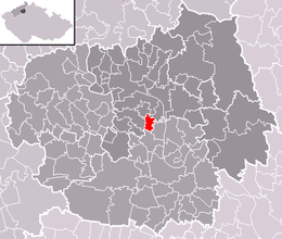
Oleško
Aspetto
This template is part of the ArticlePlaceholder extension. If you want to adjust it, please consider making your changes upstream.
comune ceco
no tipo 'e
comune ceco
nome ufficiale
Paese
unità amministrativa in cui è situato
Distretto di Litoměřice
regione storica
Boemia
coordinate geografiche
popolazione
98[12]
popolazione femminile: 45
criterio utilizzato: domicilio
popolazione maschile: 53
data: 1 Jen 2024
numero di case
altezza sul mare
163±1 m
superficie
3,266436 chilometro quadrato[18]
codice postale
412 01[19]
sito web ufficiale
prima testimonianza scritta
1226[20]
età media
codice immatricolazione
LT
categoria su Commons
Oleško
categoria principale dell'argomento
Category:Oleško
Riferimento
- ↑ Freebase Data Dumps, 28 ott 2013
- ↑ Access to Registers of Economic Subjects
- ↑ GeoNames
- ↑ Czech location identification system
- ↑ https://www.mojedatovaschranka.cz/sds/datafile?format=xml&service=seznam_ds_ovm, Ministry of the Interior of the Czech Republic, 11 Jen 2021, XML, Seznam datových schránek : Orgány veřejné moci
- ↑ https://www.czso.cz/csu/czso/ciselnik_obci_-cisob-, Istituto ceco di statistica, 26 set 2021
- ↑ Mapy.CZ, 5 ott 2020
- ↑ Register of territorial identification, addresses and real estates, 4 Giù 2023, https://www.cuzk.cz/ruian/Poskytovani-udaju-ISUI-RUIAN-VDP/Ciselniky-ISUI.aspx
- ↑ Register of territorial identification, addresses and real estates, 3 Nuv 2022
- ↑ Register of territorial identification, addresses and real estates, 31 dic 2014
- ↑ Register of territorial identification, addresses and real estates
- ↑ Q125984191, 19 Maj 2024
- ↑ 13,0 13,1 Q111647375, 18 Abb 2022
- ↑ 439232
- ↑ 439313
- ↑ 439624
- ↑ 439668
- ↑ Malý lexikon obcí České republiky - 2017, 28 Aùs 2018
- ↑ Register of territorial identification, addresses and real estates, 28 Fre 2023
- ↑ Historický lexikon obcí České republiky 1869–2005


