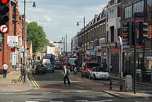
Merton
Aspetto
This template is part of the ArticlePlaceholder extension. If you want to adjust it, please consider making your changes upstream.
uno dei 32 borghi di Londra, Inghilterra
no tipo 'e
borgo di Londra
unparished area
data di fondazione o creazione
1 Abb 1965
testo del motto
Stand Fast in Honour and Strength
Paese
unità amministrativa in cui è situato
Grande Londra
contea storica
Surrey
coordinate geografiche
geoshape
carica politica del capo del governo
leader of Merton borough council
capo d''o governo
Stephen Alambritis
organo esecutivo
cabinet of Merton borough council
organismo dirigente
consiglio distrettuale di Merton
organo legislativo
council of Merton London Borough Council
popolazione
proprietario di
Plough Lane
superficie
codice postale
CR
KT
SM
SW
sito web ufficiale
portale open data
Merton Open Data Portal
identificativo WorldLift
prefisso telefonico locale
020
nun 'i e'
Merton
categoria su Commons
London Borough of Merton
categoria principale dell'argomento
Categoria:Merton
categoria di persone associate
Categoria:Persone legate a Merton
categoria per le persone nate in questo luogo
Categoria:Nati a Merton
categoria per le persone morte in questo luogo
Categoria:Morti a Merton
categoria per le viste dell'elemento
Category:Views of the London Borough of Merton
Riferimento
- ↑ Freebase Data Dumps, 28 ott 2013
- ↑ Aligned ISNI and Ringgold identifiers for institutions
- ↑ 3,0 3,1 MusicBrainz
- ↑ https://digital.nhs.uk/services/organisation-data-service/file-downloads/non-nhs-organisations
- ↑ 14 Màr 2017
- ↑ ONS lookup file of LAs for non-parished areas in England, 2019, 11 Màr 2021
- ↑ museum-digital
- ↑ iNaturalist, 25 Abb 2021, https://www.inaturalist.org/places/inaturalist-places.csv.zip
- ↑ archINFORM, https://www.archinform.net/service/wd_aiort.php, 5 Aùs 2018
- ↑ 10,0 10,1 Name Suggestion Index
- ↑ http://www.ons.gov.uk/peoplepopulationandcommunity/populationandmigration/populationestimates/datasets/populationestimatesforukenglandandwalesscotlandandnorthernireland
- ↑ https://ons.maps.arcgis.com/home/item.html?id=a79de233ad254a6d9f76298e666abb2b
- ↑ https://fr.dentist/kb/merton/


