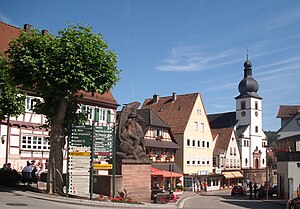
Dahn
This template is part of the ArticlePlaceholder extension. If you want to adjust it, please consider making your changes upstream.
municipality in Rhineland-Palatinate, Germany
no tipo 'e
città tedesca
unità amministrativa in cui è situato
circondario del Palatinato Sudoccidentale
coordinate geografiche
membro di
Association of municipalities and cities in Rhineland-Palatinate[12]
popolazione
4 532[13]
metodo di determinazione: statistical updating
popolazione maschile: 2 228
popolazione femminile: 2 304
data: 31 dic 2022
altezza sul mare
210±1 m
superficie
codice postale
66994
sito web ufficiale
https://www.dahn.de/
lengua 'e ll'opera o 'ro nome: Lengua germanese
prefisso telefonico locale
06391
codice immatricolazione
PS
nun 'i e'
Dahn
categoria su Commons
Dahn
categoria principale dell'argomento
Category:Dahn
categoria di persone associate
Category:People from Dahn
Riferimento
- ↑ Freebase Data Dumps, 28 ott 2013
- ↑ https://service.unece.org/trade/locode/de.htm
- ↑ 131414811
- ↑ GeoNames
- ↑ MusicBrainz
- ↑ Flickr Shapefiles Public Dataset 2.0
- ↑ Virtual International Authority File, 4 Aùs 2015
- ↑ archINFORM, https://www.archinform.net/service/wd_aiort.php, 5 Aùs 2018
- ↑ museum-digital
- ↑ National Library of Israel Names and Subjects Authority File
- ↑ archINFORM, 6 Aùs 2018, 12985
- ↑ https://www.gstb-rlp.de/gstbrp/Wir%20%C3%BCber%20uns/Mitglieder/Gemeinden%20und%20St%C3%A4dte/?prefix=Alle, 22 dic 2019
- ↑ register of German municipalities (2022), 7 ott 2023
- ↑ 10 Màr 2019, https://web.archive.org/web/20190310200237/https://www.destatis.de/DE/ZahlenFakten/LaenderRegionen/Regionales/Gemeindeverzeichnis/Administrativ/Archiv/GVAuszugQ/AuszugGV4QAktuell.xlsx?__blob=publicationFile, Statistisches Bundesamt, https://www.destatis.de/DE/ZahlenFakten/LaenderRegionen/Regionales/Gemeindeverzeichnis/Administrativ/Archiv/GVAuszugQ/AuszugGV4QAktuell.html, Alle politisch selbständigen Gemeinden mit ausgewählten Merkmalen am 31.12.2018 (4. Quartal), 10 Màr 2019


